

Long-term use of Lahendong – LoLa
Introduction
The Lahendong geothermal field is a high-enthalpy system located in North-Sulawesi province, Indonesia. The Lahendong geothermal system as the primary subject of this project produces 80 MWe from the northern and the southern reservoirs with temperatures between 250 – 350 oC (Yani, 2006). The Lahendong reservoir has been running for more than 18 years and experiences fast fluid dynamics as a result of prolonged utilization. The fluid dynamics significantly change the reservoir behaviour and the surface manifestations as reported by Suherlina, et al., 2022. Accordingly, the long-term sustainability of the Lahendong geothermal system needs to be planned appropriately in order to maintain well productivities and to prevent unexpected changes in the reservoir.
Geological Setting at the Lahendong Field
Geological Setting at the Lahendong FieldLahendong is located in the Tomohon regency, North Sulawesi, Indonesia, approximately 30 km from Manado as the capital city. The Lahendong field is located on the northern arm of Sulawesi Island. Two active subduction zones (Figure 1) form the Island; the first is Molucca Sea in the east, while the latter is Celebes Sea in the north (Utami et al., 2007). Many calderas and faults are present in the area of interest and its surrounding as result of the complicated tectonic setting and extensive volcanic eruptions (Figure 1). Four major fault trends are NE-SW, NW-SE, E-W and N-S (Koestono, 2010). The geological and structural setting is also controlled by the volcano-tectonic depression of Tondano. Andesite, tuff, ignimbrite, sediment intercalations and volcanic breccia are the predominant rock types from the Pre-Tondano, Tondano, and Post-Tondano lithologies (Koestono, 2010; Sumintadireja et al., 2001). Several volcanoes (Mt. Soputan, Mt. Mahawu, Mt. Empung, Mt. Lengkoan, Mt. Tampusu) surround the Lahendong geothermal area. Linau hydrothermal crater appears in the center of the Lahendong field, now transformed into a crater rim with a lake. Linau is an acidic- volcanic lake having pH 2-3 based on recent measurements (Brehme et al., 2019).
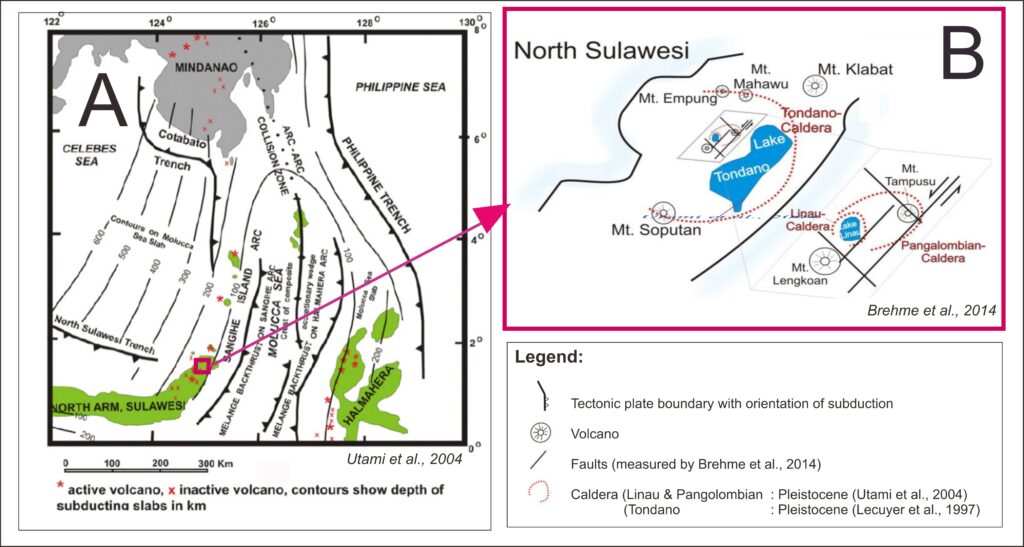
Figure 1. Structural-geological and tectonic setting in the Lahendong geothermal field (Suherlina et al., 2022)
Objectives
In this project, we aim to build the most updated 3D conceptual models of the geothermal system using an integrated approach. It will give an integrative view on the geometry and extension of the reservoir and fluid dynamics in the system. In a next step, we will simulate the production history from initial stage to recent conditions to understand changes in the geothermal system due to operation. Eventually, we will use the simulations to forecast the productivity of the Lahendong geothermal system in future years.
Methodology
Conceptual model creation involving a database including information since start of operation (2001) until recent measurements in 2018. The integrated models give insight on the whole geothermal system and are built using Leapfrog geothermal (Seequent). The meshing for the static models are carried out using MeshIt software (GFZ Potsdam). The simulation for natural state, production history matching, and forecasting scenarios will be done using the GOLEM-MOOSE simulator (GFZ Potsdam).
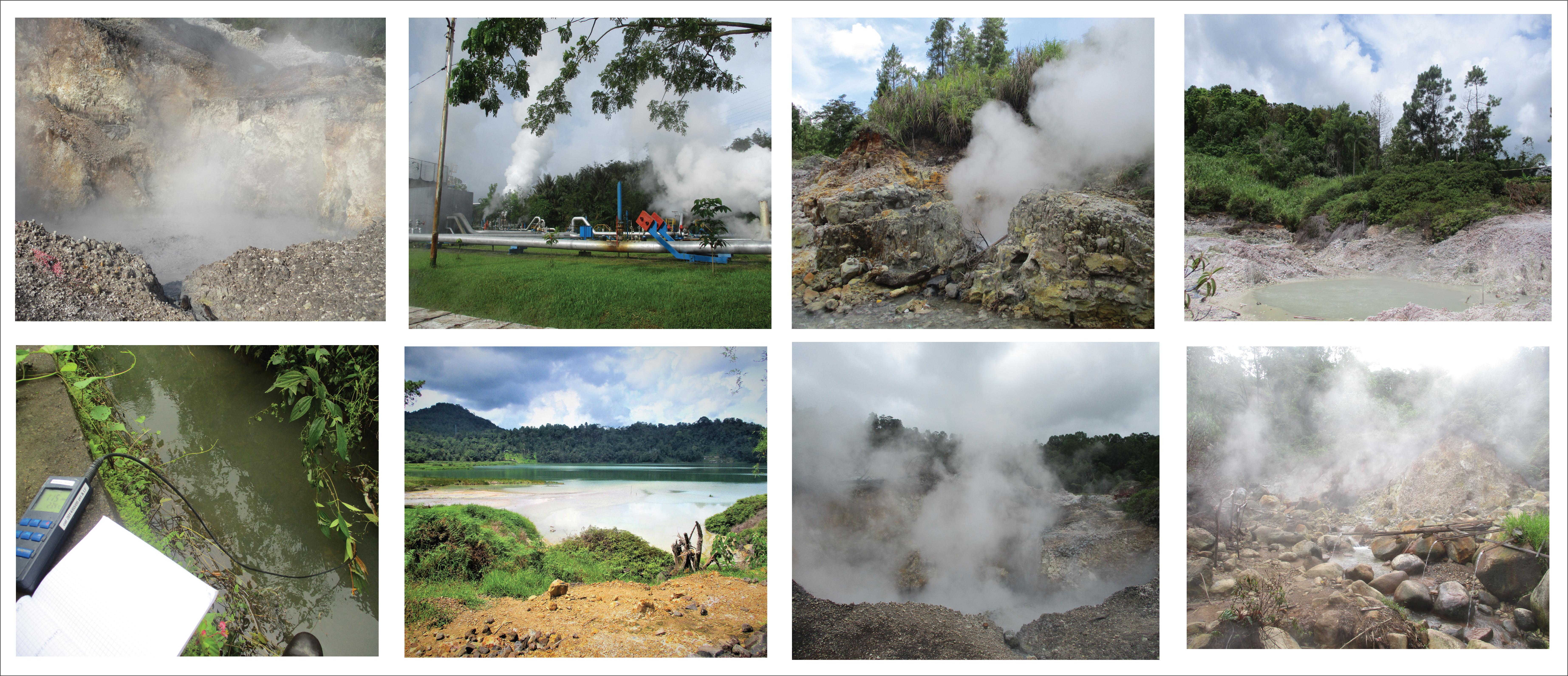
Field Impressions
Related Publications
Suherlina, L, J Newson, Y Kamah, and M Brehme, The Dynamic Evolution of the Lahendong Geothermal System in North-Sulawesi, Indonesia. , Geothermics , 105, pp. 1-19, 2022.
Suherlina, L, D Bruhn, M O Saar, Y Kamah, and M Brehme, Updated Geological and Structural Conceptual Model in High Temperature Geothermal Field, European Geothermal Congress 2022, 2022.
Suherlina, L, D Bruhn, M O Saar, Y Kamah, and M Brehme, Updated Conceptual Models in High Temperature Geothermal Field. in prep
Suherlina, L, Characterizing Reservoir Dynamics Using Hydrochemical and Structural-Geological Data in a High-Enthalpy Geothermal System, Indonesia, World Geothermal Congress, pp. 1-4, 2021.
Brehme, M, Geothermal sweetspots identified in a volcanic lake integrating bathymetry and fluid chemistry, Scientific Reports Nature Research, pp. 1-10, 2019.
References
Yani, A., 2006. Numerical Modelling of Lahendong Geothermal System, Indonesia. Reykjavik
Koestono, H., 2010. Lahendong Geothermal Field, Indonesia: Geothermal Model Based on wells LHD 23 and LHD 28. University of Iceland, Reykjavik.
Koestono, H., Siahaan, E.E., Silaban, M., Franzson, H., 2010. Geothermal Model of the Lahendong Geothermal Field, Indonesia, in: Proceedings World Geothermal Congress. Bali, pp. 25–29.
Sumintadireja, P., Sudarman, S., Zaini, I., 2001. Lahendong Geothermal Field Boundary Based on Geological and Geophysical Data, in: Proceedings of the 5th INAGA Annual Scientific Conference and Exhibitions. Yogyakarta, pp. 1–8.
Brehme, M., Giese, R., Suherlina, L., Kamah, Y., 2019. Geothermal sweetspots identified in a volcanic lake integrating bathymetry and fluid chemistry. Scientific Reports Nature Research 9, 1–10. https://doi.org/10.1038/s41598-019-52638-z
Suherlina, L., Newson, J., Kamah, Y., Brehme, M., 2022. The dynamic evolution of the Lahendong geothermal system in North-Sulawesi, Indonesia. Geothermics 105, 1-19. https://doi.org/10.1016/j.geothermics.2022.102510